

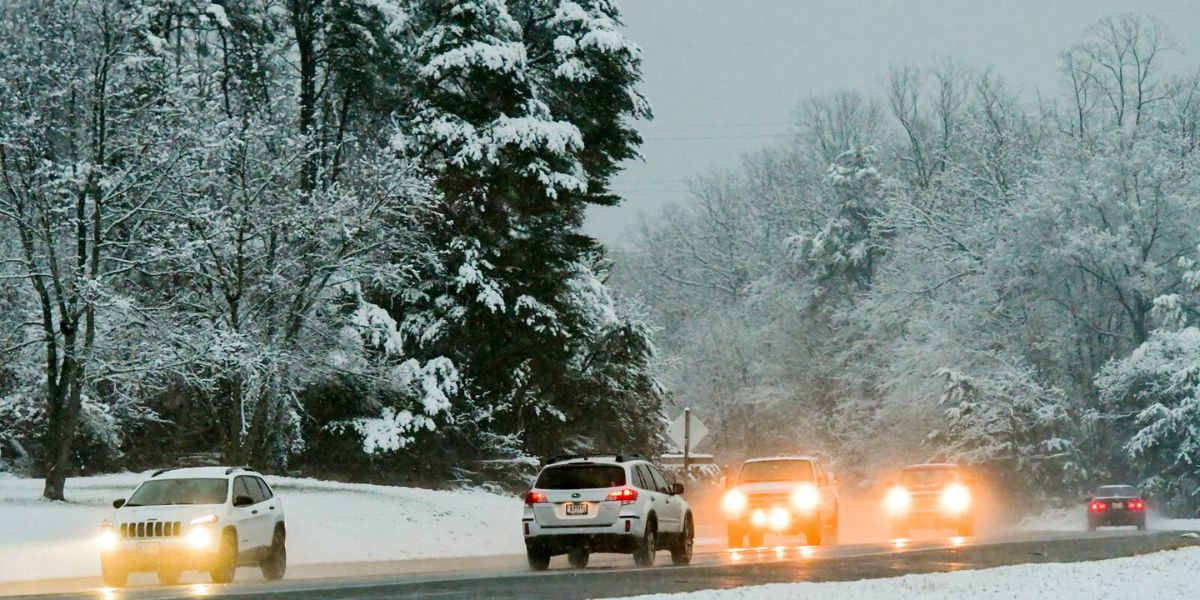
Ahead of Thanksgiving week and some of the busiest travel days of the year, several weather fronts will bring rain and snow to the Midwest, Southeast, mid-Atlantic, and Northeast.
The National Weather Service issued winter storm-related watches and warnings for nearly 25 million people late Sunday, including those pertaining to freezing temperatures, flooding, and winds.
On Monday, 4 million people from northwest Texas through central Oklahoma were under flood watches, and rain and strong thunderstorms were predicted for portions of the central and southern Plains.
West Texas, which includes Abilene, Wichita Falls, and Midland, was expected to see severe weather, which included thunderstorms, 60 mph gusts, and maybe a tornado.
Snow and rain are predicted for this week
As early as Monday, federal forecasters and academic researchers predicted that a “long duration atmospheric river” would begin in the Pacific Northwest and bring at least 3 inches of snow and 5 inches of rain to Oregon and Northern California.
A hurricane-like AR1–AR5 system was created by the Center for Western Weather and Water Extremes in San Diego to forecast the strength of atmospheric rivers.
The impending atmospheric river is expected to arrive as an AR3- or AR4-level phenomena on Friday, indicating strong to extreme precipitation. It is expected to have repercussions from Tuesday through Friday.
After leaving the Pacific Northwest, the stream of precipitation overhead might bring snow to areas of Colorado, Kansas, Nebraska, South Dakota, and Wyoming, according to the National Weather Service’s Weather Prediction Center.
Following the first atmospheric river, waves of low pressure were predicted to move into the Midwest, Southeast, and Northeast, bringing in colder air and causing possible snow into the weekend before Thanksgiving week, they added.
The National Weather Service’s Weather Prediction Center predicted that in the second half of this week, an upper-level low pressure system would form over the Northeast and the Great Lakes.
It stated that the system would block any potential warm fronts and pull down temperatures.
“This will result in cooler temperatures, a cold rain from the Ohio Valley to the East Coast, and early season accumulating snow for the central Appalachians and the higher terrain of the interior Northeast,” the center stated.
While rain and some accumulating snow are predicted for the Great Lakes, the Ohio Valley, and the Northeast, cooler, wetter fronts were predicted to impact the East Coast in the second half of this week.
The mid-Atlantic and southern New England regions might see the development and rotation of a surface cyclogenesis, a potentially significant winter storm, according to federal forecasts. This would result in temperatures dropping by 10 degrees, rain, and perhaps snow accumulation on Wednesday and Thursday.
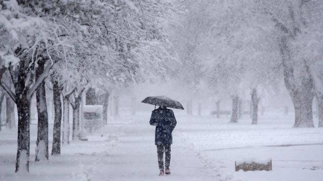
According to federal forecasters, snow may only be found in the mountain ranges and interior areas of the Northeast, but it would coincide with the drought and even wildfires that have thus far defined fall in states like New York, New Jersey, and Pennsylvania.
It might snow up to six inches, according to forecasters.
“Cold air aloft will be sufficient to support accumulating early season snow for the higher terrain near the Great Lakes and interior Northeast, and especially for the central Appalachians,” the Weather Prediction Center stated.
Read Also: Coast Guard Stops Migrant Vessel off California Coast, Over 20 Arrested
Ahead of Thanksgiving
Although federal forecasters generally refrain from predicting more than seven days in advance, they were certain that on the Sunday of the week that coincides with Thanksgiving, Black Friday shopping, and one of the busiest travel times of the year, the East Coast would experience cooler temperatures, cold rain, and high-elevation snow.
According to the U.S. Climate Prediction Center’s six- to 10-day weather outlook, which extends into the first half of the holiday week, above-average rainfall was “leaning” toward California, the Pacific Northwest, Montana, North Dakota, South Dakota, Nebraska, Iowa, Minnesota, and some Great Lakes states, including Wisconsin and Michigan.
More rain is predicted for the San Francisco Bay Area. According to the prediction center, the rest of the nation is expected to have either below-average rain or normal precipitation over that period.
Thanksgiving week appears to be continuing the post-pandemic pattern of more people traveling for the holidays. In a statement released on Thursday, American Airlines stated that it anticipates serving around 8.3 million passengers over the Christmas period, setting a new record.
The last time American Airlines carried a large number of passengers was last year, when it estimated that around 6.5 million people traveled on its and its subsidiary airlines’ aircraft.