

WPBN: Over 250,000 people are without power Saturday morning as a result of a powerful atmospheric river that is soaking much of the West Coast in torrential rains and potentially destructive wind gusts.
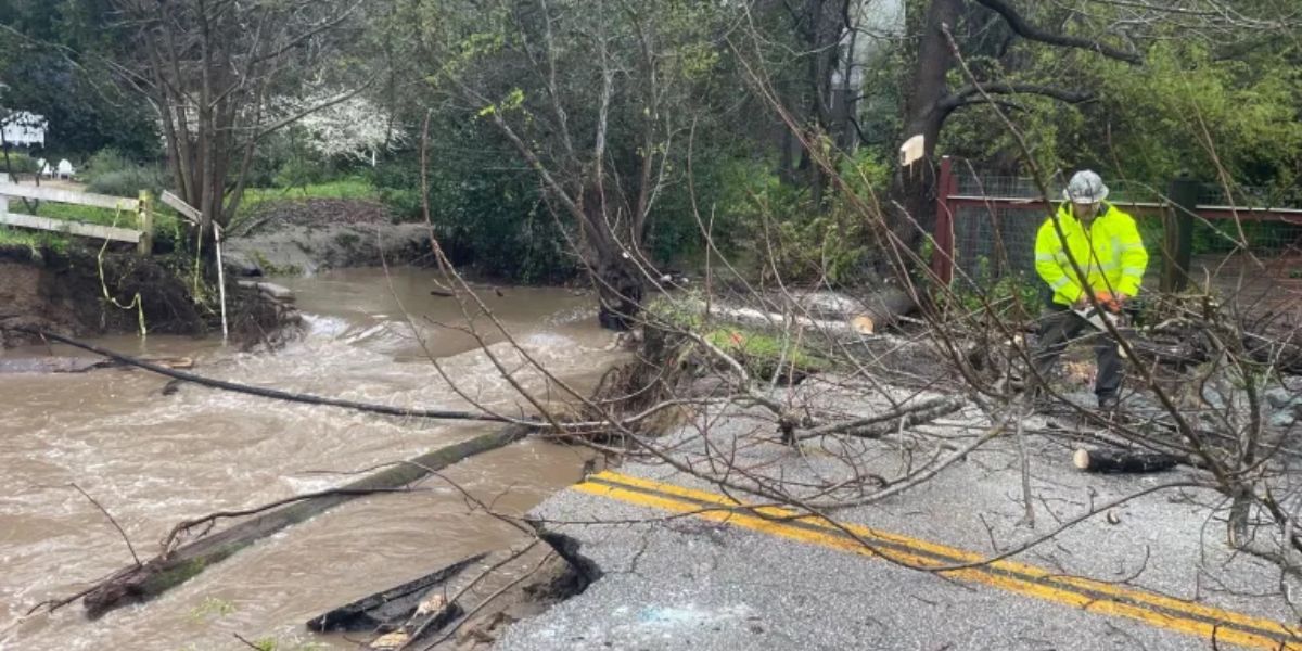
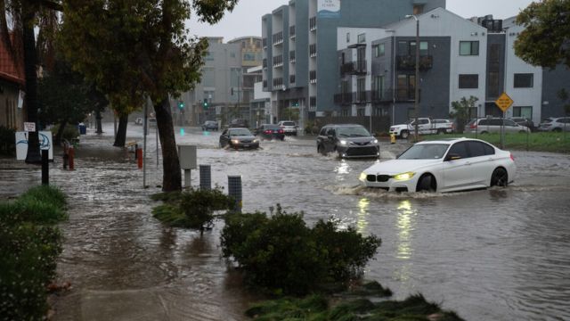
As the storm blew through Saturday morning, the San Francisco Bay Area faced several risks, including a short Tornado Warning. The North Bay and Northern California were under flood watches, with rainfall totals of two to three inches predicted in the valleys and five inches in the higher elevations.
Just before 6 a.m. on Saturday, a powerful thunderstorm blasted into the city, causing Doppler Radar to indicate rotation, prompting the issuance of a tornado warning for more than a million people in the center of Downtown San Francisco.
About 20 minutes later, the threat subsided, and there were no early reports of any damage or touchdowns. To investigate potential storm and/or tornado damage in Golden Gate Park, the Richmond District, and Crissy Field, NWS meteorologists say they are dispatching a storm survey team to the broader San Francisco area on Saturday afternoon.
San Francisco International Airport did experience a gust of 83 mph during the storm, which is thought to be the fourth-highest gust ever recorded there. In Oakland, gusts hit 59 mph, while in Monterey, they hit 78 mph.
According to the National Weather Service, Saturday’s tornado warning was thought to be the first one ever issued for the city of San Francisco.
Through Saturday morning, the Bay Area was under a Level 1 out of 5 severe weather danger from NOAA’s Storm Prediction Center, which warned of potentially severe thunderstorms that might produce large hail, destructive wind gusts of over 55 mph, and the possibility of an isolated tornado.
Additionally, the Bay Area is at Level 2 out of 4 danger for flash floods, according to the Weather Prediction Center. The center of Downtown San Francisco is under a flood advisory because to the possibility of flooded roads and underpasses.
Winter Storm Warnings are in force for the Sierra Nevada further east, where significant snowfall is anticipated. In the upper altitudes, up to 8–20 inches are anticipated.
Along the mountain ridgetops, wind gusts might reach 120 mph, while in the valleys, they could exceed 45 mph. On Saturday morning, the Alpine Meadows Ski Resort’s Ward Peak wind gauge recorded a gust of 159 mph.
As the storm passes inland later Saturday, the Bay Area and Northern California will see better weather.
WPC issues Day 1 Slight Risk Excessive Rainfall Outlook at Dec 14, 8:24z for MTR https://t.co/XfxetxXk6z pic.twitter.com/0l9zvgjMv8
— IEMBot MTR (@iembot_mtr) December 14, 2024
Western Washington is battered by strong winds and coastal floods.
With a combination of intense rains and high winds, the storm posed a major risk of coastal flooding for the Pacific Northwest.
On Saturday morning, when High Wind Warnings were in force, gusts along the Washington coast hit 62 mph in Forks and 61 mph in Hoquiam.
Significant storm surge and coastal flooding were threatened by a perilous confluence of low air pressure, strong spring tides, and pounding surf of 20 to 23 feet.
During high tide late Saturday morning, NWS Seattle issued a warning that flooding along shorelines and low-lying regions could reach depths of 2.5 to 3.5 feet.
“This is expected to lead to numerous road closures,” according to NWS Seattle. “Low lying property including homes, businesses, and some critical infrastructure may be inundated. Shoreline erosion or damage may occur.”
Early next week, the West Coast will see another atmospheric river, the third of the week, albeit it is anticipated to be weaker than the one on Saturday.