

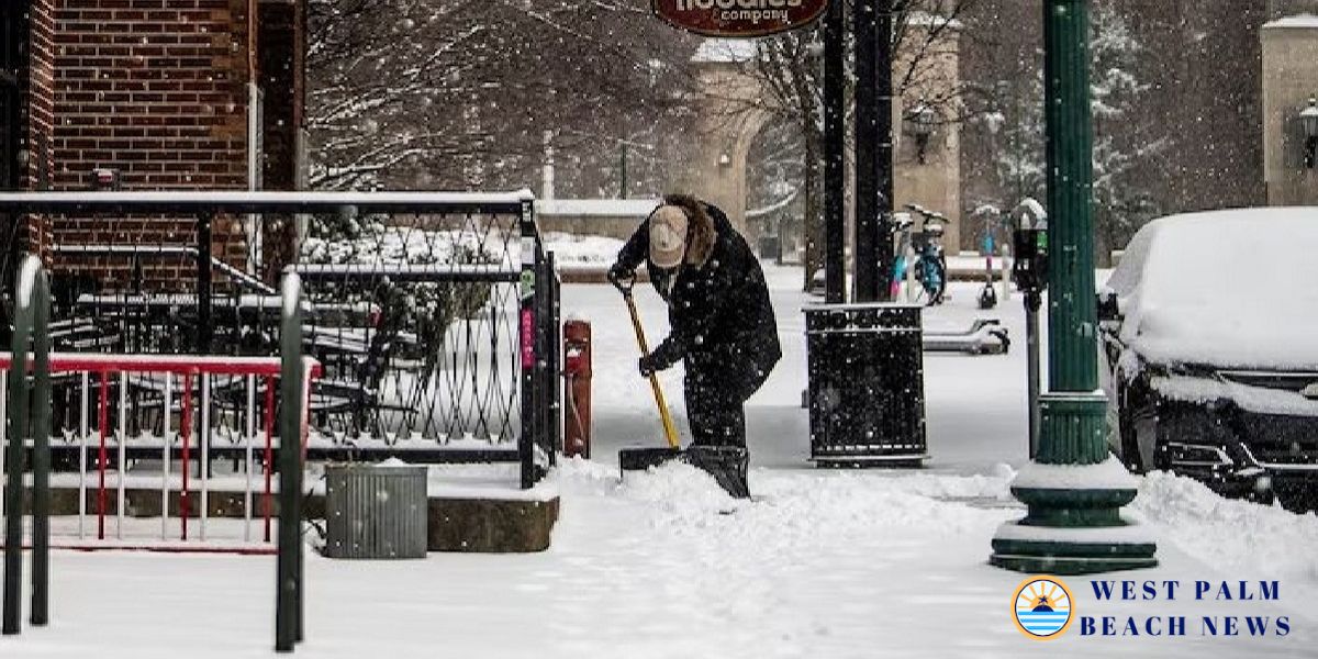
WPBN: As a disruptive winter storm threatened to bring the most precipitation in a decade to certain regions of the central U.S. on Sunday, a flurry of snow, ice, wind, and freezing temperatures created hazardous travel conditions.
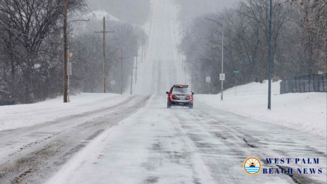
Major roads throughout almost all of Kansas, western Nebraska, and portions of Indiana were covered in snow and ice, prompting the state’s National Guard to be called in to assist any stranded drivers.
The National Weather Service issued winter storm warnings for Kansas and Missouri, where blizzard conditions brought wind gusts of up to 45 mph (72 kph), and predicted at least 8 inches (20 centimeters) of snow, especially north of Interstate 70. New Jersey was also under the warning for Monday and the first part of Tuesday.
“For locations in this region that receive the highest snow totals, it may be the heaviest snowfall in at least a decade,” according to the weather service.
The North Pole is often encircled by the polar vortex of extremely cold air. When the vortex breaks free and moves south, people in the United States, Europe, and Asia are hit by the extreme cold.
According to studies, the polar vortex’s rising frequency of extending its icy grasp is partially caused by the Arctic’s rapid warming.
The prediction is for snow, ice, and possibly even tornadoes.
Parts of U.S. Route 41, Interstate 64, and Interstate 69 were completely buried in snow in Indiana. As plows attempted to keep up with the rate of the precipitation, Indiana State Police urged drivers to avoid the highways.
areas of Kansas have received around 10 inches (25 centimeters) of snow, and areas of Kansas and northern Missouri were expected to receive more than 14 inches (36 centimeters) of snow and sleet.
On Sunday, Louisville, Kentucky, recorded 7.7 inches (19.5 centimeters) of snow, breaking the previous record of 3 inches (7.6 centimeters) set in 1910. With 5 inches (12.7 cm) of snowfall, Lexington, Kentucky, also established a record.
A lake effect event that is predicted to continue until late Sunday afternoon dumped at least three feet (0.9 meters) of snow on parts of upstate New York.
A hard freeze was predicted as far south as Florida when the storm moved across the Ohio Valley and made its way to the Mid-Atlantic states later Sunday and Monday.
Throughout the Deep South, trees were felled by damaging winds. On Sunday, the meteorological agency warned of tornadoes in Mississippi, Louisiana, and Arkansas.
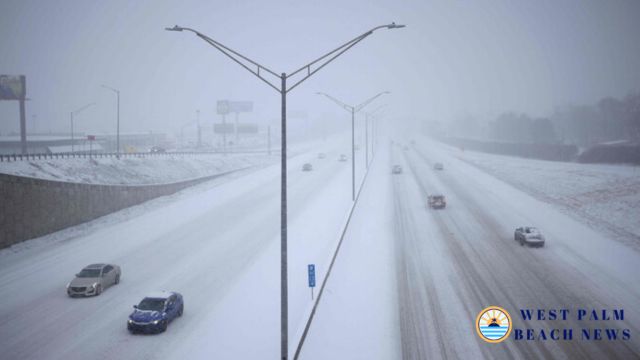
As the storm comes, there are more car crashes.
In Virginia, Indiana, Kansas, and Kentucky, hundreds of auto accidents were reported. One state trooper was hospitalized for non-life-threatening injuries when his patrol car was struck on Interstate 65. The highway police in Missouri said that at least 600 drivers were stuck in the state.
According to the state’s Transportation Department, “impassable” circumstances forced the closure of highways in northeastern Kansas. Approximately 220 miles (354 kilometers) of Interstate 70, the state’s principal thoroughfare, which runs from the Missouri border into central Kansas, were closed.
State buildings would be closed Monday, according to Kentucky Governor Andy Beshear, who issued a state emergency proclamation prior to the storm.
Could Declawing Cats Soon Be Banned in New Hampshire? Lawmakers Revisit Issue
As the storm moved into the state on Sunday, Virginia State Police reported at least 135 wrecks. There were a few injuries recorded.
By Sunday evening, authorities in Charleston, West Virginia, where several inches of snow had fallen, advised drivers to stay at home. According to the Kanawha County Sheriff’s Office, deputies were responding to 911 calls and collisions around the county. “If you have dialed 911 for help, please be patient. A deputy will contact you or get back to you as soon as possible, according to a statement from the sheriff’s office.
Temperatures decrease, but no records are broken.
According to experts, the eastern two-thirds of the nation will be hit by wind chills and dangerously frigid temperatures starting Monday. It may be 12 to 25 degrees (7 to 14 degrees Celsius) colder than usual.
Sunday temperatures dropped to 11 below (-11.7 Celsius) in International Falls, Minnesota, on the Canadian border, while in Chicago they were in the teens (minus 7 to 10 Celsius) and around zero in Minneapolis.
After a largely warm start to winter, the Northeastern states are more likely to have several days of cold, according to Jon Palmer, a National Weather Service meteorologist in Gray, Maine. He predicted a cold but dry week due to a plume of cold air flowing down from Canada.
Palmer stated that parts of the East Coast will likely experience freezing temperatures and lows in the single digits, with the cold air likely to engulf the eastern half of the country as far south as Georgia.
Palmer added that as the week progresses, the wind may also increase, creating potentially hazardous circumstances for anyone who spend a lot of time outside.
Amid Backlash, New York Becomes First U.S. City to Adopt Congestion Charge
The disturbances spread southward
The Annapolis, Maryland, area was expected to receive 8 to 12 inches (about 20 to 30 centimeters) of snow, according to the National Weather Service. Ahead of the storm, Virginia Governor Glenn Youngkin issued a statement on X, urging citizens to cast their ballots before Tuesday’s special elections.
Similar proclamations were made at cities in central Illinois, West Virginia, Kansas, and Maryland.
Reference – The heaviest snowfall in a decade is possible as a wintry blast roils parts of the US