

The National Oceanic and Atmospheric Administration has predicted potentially severe and historic tornadoes for Oklahoma and other surrounding states on Monday.
The highest severe weather risk alert, available, was issued by NOAA’s Storm Prediction Center in Norman, Oklahoma, for many strong, long-track tornadoes on Monday afternoon and evening.
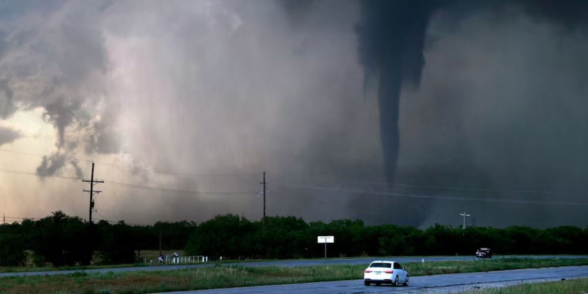
Certain tornadoes have the potential to persist long into the night. Tornadoes at night can be quite deadly. For severe storms, this is the first “high risk” rating that Oklahoma has seen this year and since 2019.
Significant severe storms, particularly in Kansas and Oklahoma, are predicted for Tornado Alley, which stretches from Nebraska to Texas.
All forms of severe weather are predicted to manifest as isolated storms that could eventually, and possibly very quickly, create a line of supercells moving eastward.
It’s conceivable to have several powerful tornadoes with enormous hail that resembles softballs. Winds as high as 80 mph were possible during the catastrophic thunderstorms.
Storms are expected to start developing from Nebraska into Kansas at 3 p.m. ET, from Kearney, Nebraska, to Hays, Kansas.
Everyone needs to be on guard, especially near the onset places, as storms will likely “come out of nowhere” and rapidly grow in size once they are sparked.
Before any storms form, tornado watches are probably going to be issued. When they are distributed, people will need to be prepared for anything at any time.
Through 12 p.m. ET, a “particularly dangerous situation” tornado watch has been issued for portions of far northern Texas (including Wichita Falls), much of Oklahoma (including OKC), and south-central Kansas (including Wichita).
Storms are forming and intensifying rapidly by 6 p.m. ET, extending from central Oklahoma to Nebraska. Massive hail up to the size of a softball and strong, long-track tornadoes are probable right now.
Read Also: Nebraska and Iowa Governors Advocate for Federal Disaster Aid After 2024 Tornado Outbreak
By 8 p.m. ET, storms will still be moving east, hitting Wichita, Kansas, and the severely damaged Beatrice, Nebraska, area.
By 12 ET, further storms could form east of Oklahoma City, which was severely damaged by tornadoes at the end of April. Then, a storm line with the potential for all sorts of severe weather forms, stretching from Tulsa, Oklahoma, to Joplin, Missouri, and Kansas City, Missouri.
By dawn, the line finally ends as it approaches Paducah, Kentucky, after continuing eastward during the night. On Tuesday and Wednesday, there will be a renewed danger of storms due to new energy.