

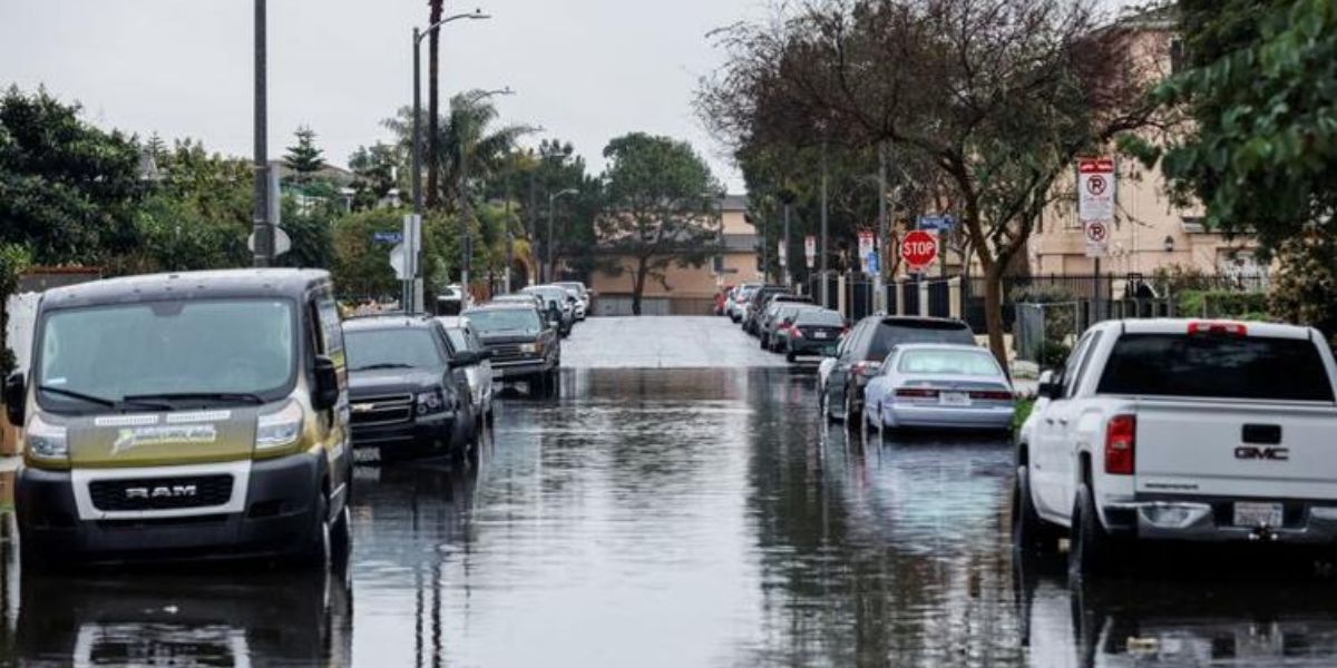
A significant storm hit California on Sunday, bringing heavy rainfall and hurricane-force winds. The impact was widespread, with power outages affecting 750,000 customers, and there’s a looming threat of serious floods as forecasters anticipate the storm to linger over major cities for the next day or two.
This marks the second occurrence of a Pineapple Express weather system, or atmospheric river storm, in the state within the past week.
The timing coincided with the Grammy awards in Los Angeles, leading to challenging conditions for attendees navigating heavy rain, despite efforts to tent the red carpet. Some individuals braved the weather in glamorous cocktail attire, relying only on handbags as makeshift umbrellas.
The severity of the conditions prompted the National Weather Service’s Bay Area office to issue a rare hurricane-force wind warning for Big Sur and nearby areas.
Governor Gavin Newsom declared a state of emergency in eight counties, including San Diego, collectively home to over 20 million people. Flash flood warnings were also issued for Santa Barbara and San Luis Obispo counties.
Rain totals have increased for northern areas, where locally catastrophic and life-threatening flooding is expected for Orange County, western parts of the Inland Empire, and SBD Mtn coastal slopes ⚠️ #CAwx
Please watch our latest video for more info: https://t.co/5uL6SpiokX pic.twitter.com/Lqzp73gMYe
— NWS San Diego (@NWSSanDiego) February 5, 2024
In San Diego County, a flood watch is in effect from 4 p.m. Sunday until 10 a.m. Wednesday, expecting 2-4 inches of rainfall over a three-day period, accompanied by gusty winds.
However, Orange County and areas northward are anticipated to experience even greater rainfall.
Los Angeles Mayor Karen Bass stated at a press conference that “this has the potential to be a historic storm, severe winds, thunderstorms, and even brief tornadoes.”
In addition to being completely saturated, the storm was predicted to stall over parts of the San Francisco Bay Area and Los Angeles County into Tuesday, greatly increasing the potential of flooding and mudslides.
“The Monday evening commute is going to be a complete disaster to say the least. In fact, it’s going to be bad enough that I would recommend everybody stay home in L.A. if we possibly can,” warned Daniel Swain, a climate scientist at the University of California Los Angeles, during a live-stream on Sunday.
The National Weather Service (NWS) recorded peak wind gusts of 80 mph or higher in certain areas.
As of Sunday afternoon, PowerOutage.us reported that nearly 750,000 homes and businesses were without electricity.
“This is a DANGEROUS SYSTEM with major risks to life and property. Substantial flooding. Residents should heed any evacuation orders,” the Los Angeles office of the NWS stated on social media. “Stay off the roads, especially the freeways, this afternoon through at least Monday morning.”
The mayor of Long Beach, near Los Angeles, anticipates the city receiving more rain this week than its annual total, with 5-7 inches expected from Sunday to Tuesday.
The U.S. National Weather Service warns of an inch of rain per hour and total amounts of 3-6 inches along California’s southern and central coasts, while foothills and lower-elevation mountains may see 6-12 inches.
Both Los Angeles and Santa Barbara areas face a high risk of excessive rainfall on Sunday and Monday, prompting evacuation orders for residents in affected counties, including San Jose and Ventura County.