

As storms travel across the Chicago area, a severe thunderstorm warning was issued for Newton, Jasper, Lake, and Porter counties in Indiana until 1:15 a.m.
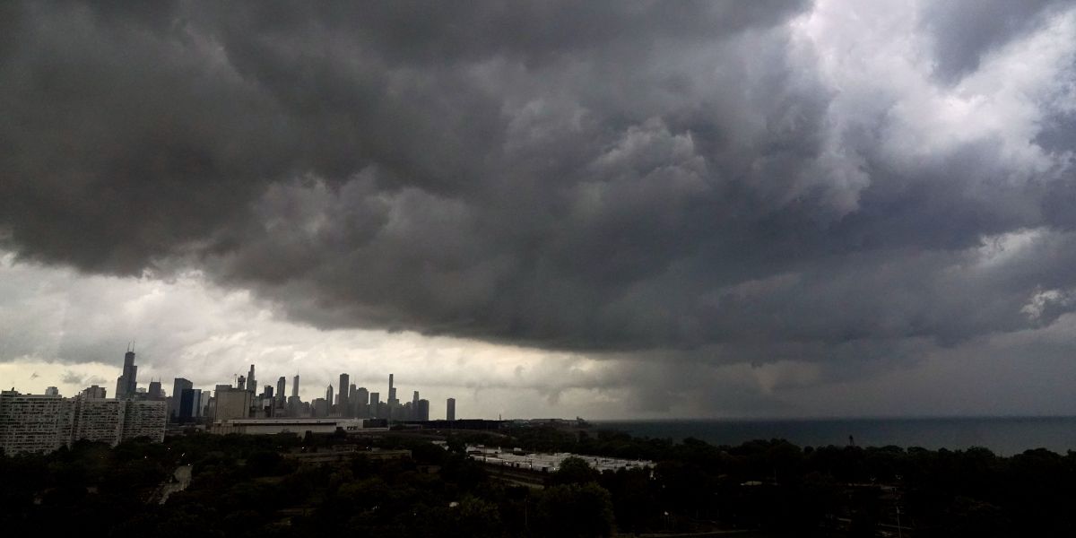
Late on Sunday night, as a series of strong storms swept across the region, uprooting trees and causing flooding, a brief tornado warning was issued for downtown Chicago and other core locations.
By 10:50 p.m., the tornado warning that was in effect until 11 p.m. had been canceled. It was a relatively short section, running through Bridgeport, Back of the Yards, the South Loop, and Bronzeville in the south, and Old Town in the north.
Although there were no confirmed tornado reports in the city, the storm’s spin signature was significant enough to trigger a warning. But there were numerous reports of wind damage brought on by the storm.
This tornado warning comes after a number of others that were issued as the storms moved through. Law enforcement earlier reported that just after 9:30 p.m., a probable tornado was on the ground northwest of Elburn, close to Meredith and Beith roads.
A funnel cloud was observed earlier near the Belvidere Oasis on the Jane Addams Memorial Tollway.
Additionally, a tornado warning was issued for LaSalle and Livingston counties after midnight, but it was canceled around 12:30 in the morning. As the storm system hammered its way through, severe thunderstorm warnings were issued county after county.
By 11:25 p.m., the severe weather had left the city of Chicago; nevertheless, a severe thunderstorm warning for Northwest Indiana and the counties to the south and southwest of Chicago persisted until early Sunday morning.
Pea-sized hail and wind gusts up to 60 mph were brought by the storm system earlier.
Up to 1:30 a.m., the southwest Will, southern DuPage, and southeast Cook counties are under a flash flood warning. There is a flood watch in place for the area through Monday at 4 a.m.
Read Also: Marshall County Authorities Seek Public Help in Finding Missing 25-Year-Old
Widespread flash flooding occurred in certain areas of far northern Illinois on Saturday night; more heavy rain is expected to result in quick water rises and the possibility of substantial flash flooding occurring again.
Monday is going to be hot and windy, especially in the late hours of the night. With highs in the middle 90s and a heat index of 100 to 106 degrees, the day will get dangerously hot.
The region is under a level 3 storm threat on Monday, according to the Storm Prediction Center. The risk for Sunday night is significantly higher than it was predicted to be.