

Thursday saw yet another day of extreme weather over Texas and the southern Plains, with flooding being recorded in the Dallas area and a tornado warning in the vicinity of Midland.
As they raced over North Texas, north and south of the Red River, thunderstorms started to form on Thursday morning. However, they didn’t get strong enough to be considered severe until the afternoon and evening.
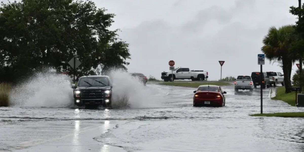
Around midday, the storms made their way into the Dallas-Fort Worth Metroplex, where they posed a threat of lightning strikes and wind gusts up to 60 mph. In addition to the thousands of power outages caused by storms earlier this week, there will likely be further ones.
Around Midland, a supercell thunderstorm had formed by Thursday night. It caused the local National Weather Service office to declare West Texas’ first-ever tornado emergency.
At Midland International Air & Space Port, which is situated between Odessa and Midland, storm chasers and travelers reported seeing at least one tornado.
Before being led into safety, passengers claimed to have seen two tornadoes from the terminal.
A single mobile home that was overturned and multiple downed power wires were reported to the local emergency management agency. Thankfully, the storm was not blamed for any deaths in Midland County.
Over 4,000 consumers lost power right away as a result of the storms, according to PowerOutage.us. In the community of Gardendale, hail the size of baseballs has also been observed north of Interstate 20.
Read Also: Texas Tornado: Deadliest Since 2015 Leaves 7 Dead, Children Among Victims
Friday is probably going to see more strong storms
On Friday, the risk of severe storms will move eastward, affecting the denser parts of East Texas, Southeast Oklahoma, and Western Louisiana.
By Friday morning or early afternoon, one or two structured clusters of storms may develop. By Friday evening, there is a chance that severe wind and hail will continue throughout portions of the southern Plains into the lower Mississippi Valley, Texas Gulf Coast, and Deep South Texas.
Read Also: Tornado Outbreak from Texas to North Dakota, Eastward Threat Looms
Flash floods may occur again in cycles
This week, there is a chance of flash flooding throughout the Plains and as far north and east as the Midwest. Every day, the bull’s-eye for the most intense rain will move, reversing course and going from the south to the north again.
With three to five inches of rain predicted to shower the area, major cities like Dallas are facing severe weather and the possibility of flash flooding.
While some places in the middle Plains would like to take advantage of the rainy weather, many places in the South are seeing far more rain than usual this year.
You may be sure that this week will bring some rain to most people in the country’s center.